Specialized Drone Data Annotation for Smarter AI Models

Optimize drone imagery and aerial data for machine learning with our expert drone data annotation services, tailored for applications such as object detection, environmental monitoring, and precision agriculture.

Our Drone Data Annotation Services

At Annotation Workforce, We provide comprehensive drone data annotation services, including object detection, bounding boxes, semantic segmentation, 3D image annotation, LiDAR data, and more, tailored to enhance AI models for various industries. Our expertise covers:
Object Detection

Object Detection

Object Detection
We provide expert object detection services for drone imagery, accurately identifying and labeling objects such as buildings, vehicles, and infrastructure. Our precise annotations using bounding boxes ensure that your AI models can detect and classify objects efficiently for various applications.

Bounding Boxes

Bounding Boxes
Our bounding box annotations pinpoint critical objects within aerial imagery, including rooftops, vehicles, and structures. This essential service helps in object localization and detection, making it ideal for model training in tasks like warehouse automation and urban planning.
Bounding Boxes
Semantic Segmentation​

Semantic Segmentation

Semantic Segmentation​
We offer semantic segmentation services to label specific areas of interest, such as roads, vegetation, and water bodies, in drone images. This technique is crucial for applications like terrain analysis and environmental monitoring, providing AI with detailed, contextual data for better decision-making.

Polygonal Annotation

Polygonal Annotation​
With our polygonal annotation service, we provide highly detailed labeling for irregular shapes such as agricultural fields, solar panels, and construction sites. This service is essential for precision agriculture, solar energy, and other industries that require precise, detailed area segmentation.
Polygonal Annotation​

3D Image Annotation

We specialize in annotating 3D drone imagery, providing detailed labeling for complex models and simulations. This service enhances your AI’s ability to process and analyze spatial data, making it ideal for applications such as construction monitoring and urban planning.

LiDAR Data Annotation

Our LiDAR data annotation service processes 3D point cloud data to enhance terrain analysis, environmental monitoring, and mapping projects. We accurately label depth information, improving AI models’ ability to assess landscape features, vegetation, and infrastructure in great detail.
Surveillance Projects​

Surveillance Projects

Surveillance Projects​
We provide specialized annotation services for surveillance projects, ensuring that AI can effectively detect and track objects of interest in drone-captured images. Whether for security monitoring or law enforcement, our services support efficient analysis of large-scale aerial surveillance data.

Scalable Solutions

Scalable Solutions​
Our scalable solutions are designed to meet the demands of large-scale drone data annotation projects. Whether you need to process thousands of drone images or extensive video footage, our team adapts quickly to deliver high-quality annotations, ensuring that your AI models receive consistent, accurate data.
Scalable Solutions​
Warehouse Automation​

Warehouse Automation

Warehouse Automation​
We offer tailored drone data annotation services to improve warehouse automation. By labeling objects like shelves, products, and packages in drone images, we provide the crucial data required to train AI models for tasks such as inventory tracking, sorting, and automated management in warehouse environments.

Environmental Monitoring

We specialize in environmental monitoring through detailed drone data annotation, enabling AI to analyze environmental changes. From tracking deforestation to monitoring pollution levels, our service helps organizations capture critical insights and make informed decisions based on aerial imagery.

Why Choose Us

Unparalleled Subject Matter Expertise: With unparalleled subject matter expertise, Annotationworkforce delivers exceptional data annotation services across various domains. Our team of skilled professionals ensures that every project is handled with the utmost precision, offering deep insights and tailored solutions to meet your unique business needs, driving results.

Quality With Accuracy

Achieving Precision and Quality in Every Data Annotation Project for Your Business.

Customized Solutions

Tailored Data Annotation Solutions to Meet Your Unique Business Needs and Goals.

Cost-effective Pricing

Affordable and Cost-Effective Pricing for High-Quality Data Annotation Services.

Frequently Asked Question

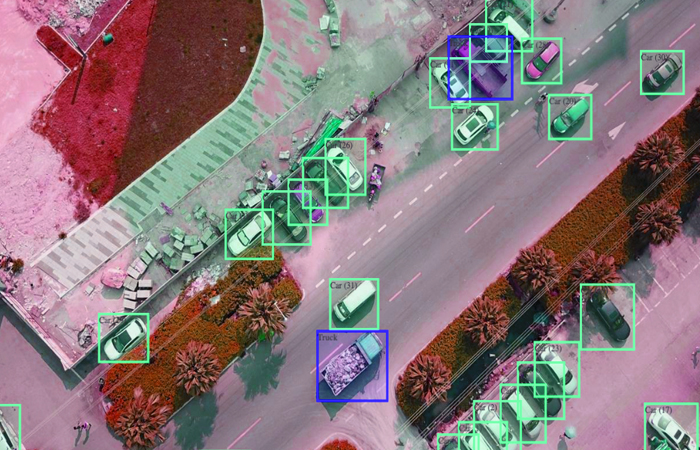
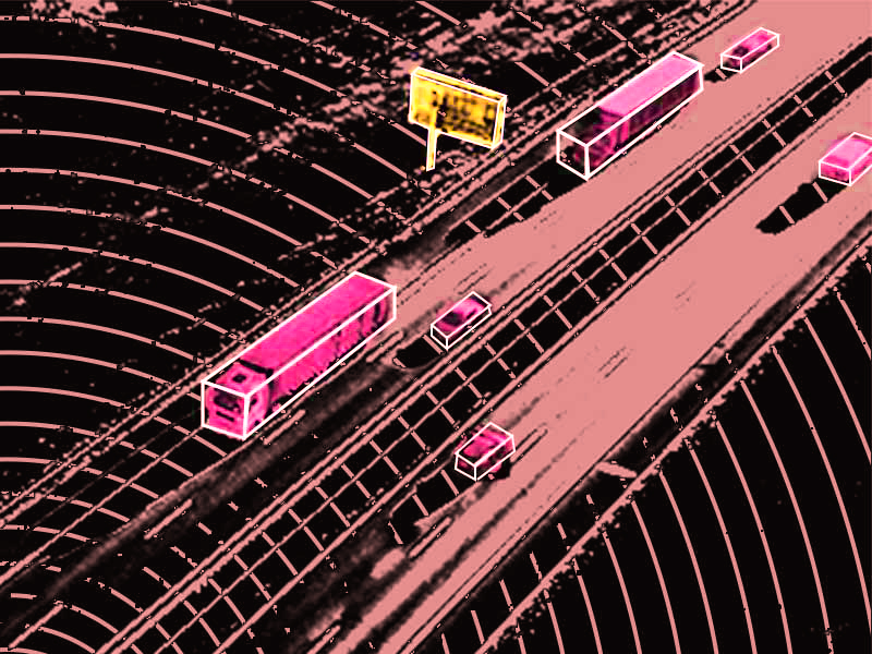
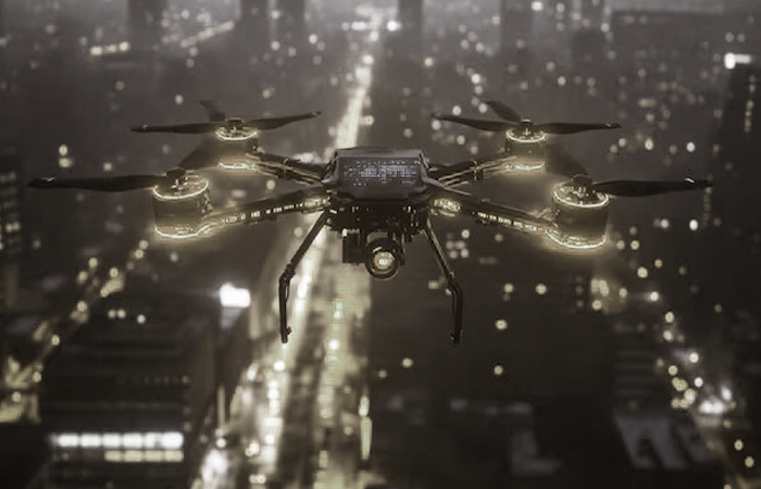
Drone data annotation involves labeling aerial imagery captured by drones to enhance AI models, such as for object detection, terrain analysis, and environmental monitoring.
The time required varies by project size and complexity. Smaller tasks can take a few days, while larger datasets may require several weeks.
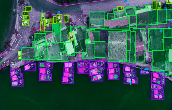
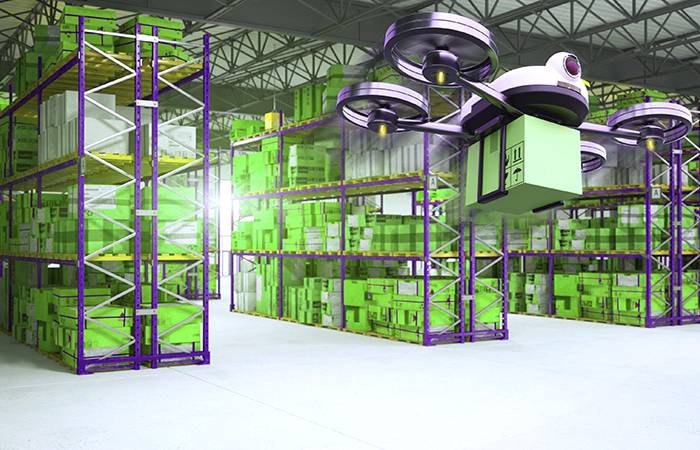
Industries like agriculture, environmental monitoring, surveillance, warehouse automation, construction, and defense benefit from high-precision drone data annotation.
We use a multi-stage review process and advanced tools to ensure all annotations are accurate and consistent for model training and real-world application.
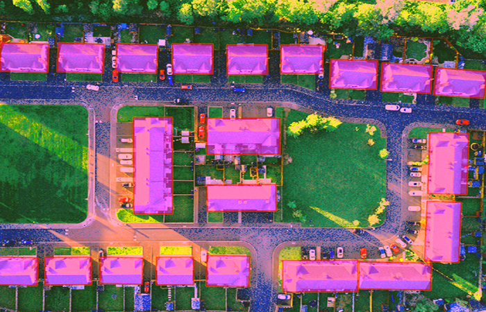
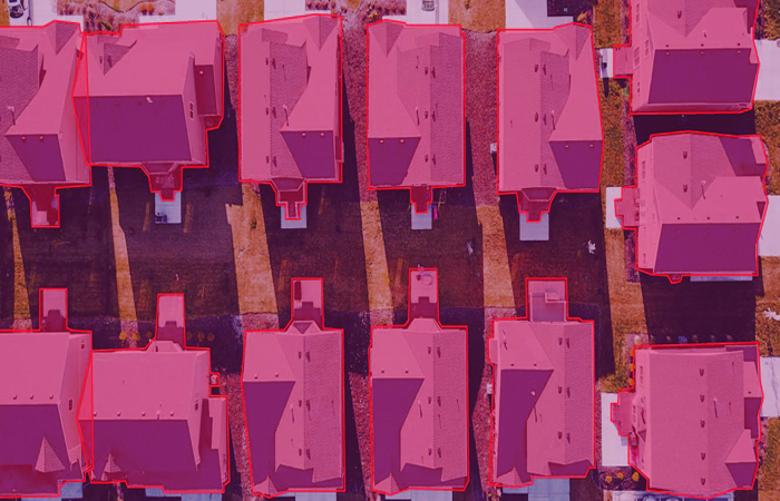
Semantic segmentation labels areas based on their type (e.g., roads, vegetation), while object detection identifies specific objects (e.g., buildings, vehicles) within the imagery.
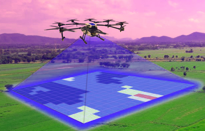
Polygonal annotation is crucial for irregular shapes, making it ideal for tasks like precision agriculture, where crop fields and solar panels need detailed segmentation.
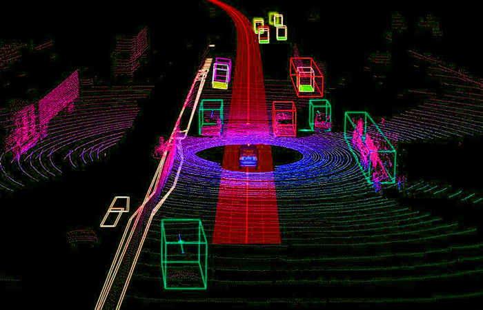
LiDAR data provides 3D point cloud information, enhancing terrain analysis and environmental monitoring by offering highly detailed depth and structure data.
We combine experienced annotators with cutting-edge tools, offering scalable solutions and industry-specific expertise to ensure highly accurate, reliable annotations for your projects.
Yes, we provide 3D image annotation services that help improve simulations and modeling for advanced AI applications in various industries.
Our services are highly scalable, allowing us to quickly adapt to large volumes of drone data, ensuring fast, accurate annotations for both small and large projects.