Geospatial Data Annotation for AI-Driven Mapping Solutions
Optimize geospatial imagery and data for machine learning with expert annotation services. Enhance AI models for applications like urban planning, environmental monitoring, and land management.
At Annotation Workforce, we offer specialized geospatial data annotation solutions designed to support AI in industries like agriculture, construction, and urban planning. Our services include:
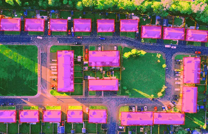
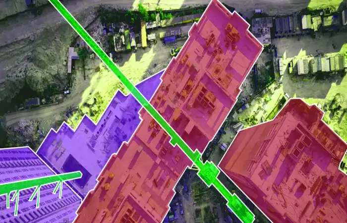
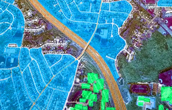
Bounding Box Annotation
We provide 2D and 3D bounding box annotation to identify and mark objects like buildings, roads, and vegetation in geospatial data. This helps in AI tasks such as object detection, land-use analysis, and infrastructure mapping.
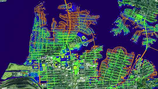
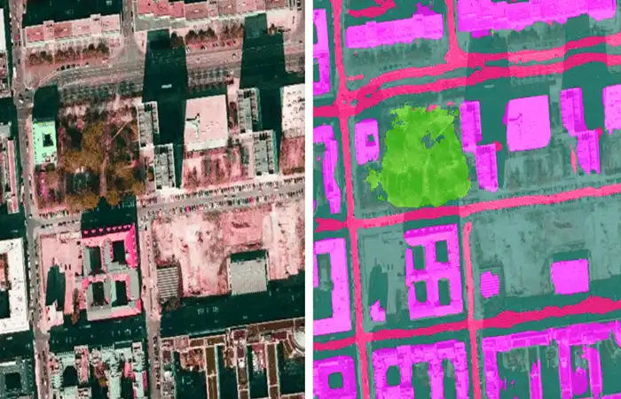
Semantic Segmentation
Our semantic segmentation labels regions such as roads, water bodies, and vegetation to improve AI’s understanding of geospatial features. This supports applications in environmental monitoring, urban planning, and terrain analysis by categorizing specific areas.
Polygonal Annotation
For irregular or complex areas like agricultural fields, bodies of water, or solar farms, we offer polygonal annotation. This ensures precise segmentation of boundaries for applications such as precision agriculture and land management.
3D Data Annotation
We annotate 3D geospatialdata from sources like LiDAR and aerial imagery, providing depth and spatial relationships that are crucial for urban planning, construction, and environmental monitoring projects. This enables accurate modeling of terrain and structures.
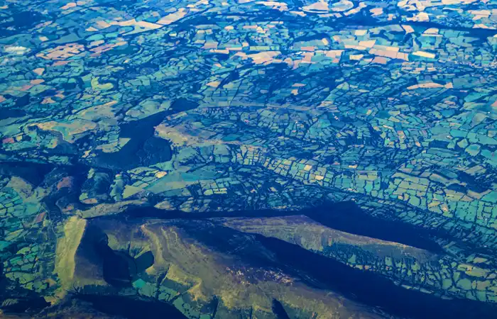
Remote Sensing Annotation
Our remote sensing annotation service helps AI systems interpret satellite, drone, and other aerial data to track environmental changes, monitor deforestation, and assess pollution, making it ideal for environmental monitoring and land-use management.
Geospatial AI Training
We provide precise labeling for AI model training, focusing on drone geospatial data, GIS data, and satellite imagery. Our services enhance AI models used in industries like agriculture, urban planning, and environmental monitoring for better decision-making.
It involves labeling geospatial data (e.g., satellite, drone, or aerial imagery) to enable AI systems to analyze and process geographical information for mapping and analysis.
Industries like agriculture, urban planning, defense, construction, and environmental monitoring benefit from geospatial annotation to make data-driven decisions.
2D bounding boxes are used in flat images, while 3D bounding boxes are used for spatially aware data like LiDAR or 3D models for terrain and object analysis.
Polygonal annotation is critical for accurately marking irregular areas, such as fields, water bodies, or solar farms, enabling precise analysis for agriculture and land management.
LiDAR data provides depth information, enabling AI to create accurate 3D models of terrain and structures, which is useful for urban planning and environmental monitoring.
Our team combines expert knowledge with advanced tools, ensuring highly accurate, scalable geospatial data annotation for a wide range of industries and applications.
Yes, we specialize in annotating drone geospatial data, helping AI models analyze aerial imagery for applications like precision agriculture and urban planning.
Our services are highly scalable, capable of handling both small and large datasets with the same level of accuracy and efficiency, ensuring timely delivery.
We use a robust quality control process and cutting-edge annotation tools to ensure precise and consistent data, helping deliver reliable insights for geospatial AI applications.